Rocky Point Community Forest
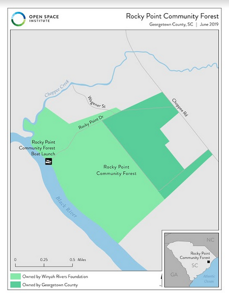
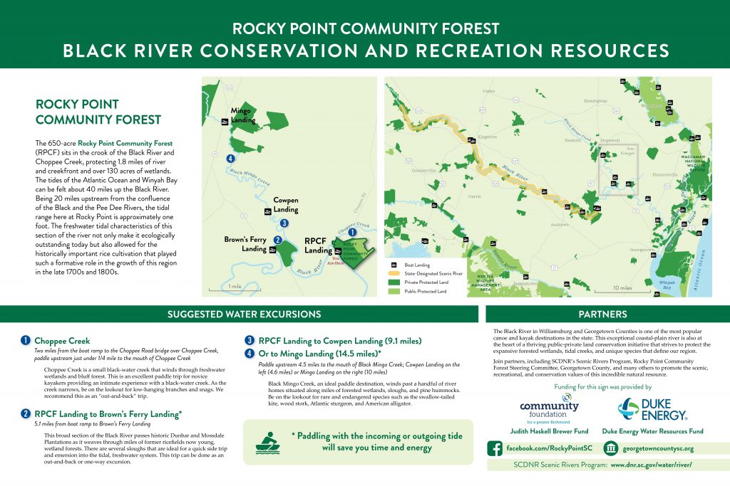
The 650+ acres that lie within the boundaries of Choppee Road, Choppee Creek and the Black River in Georgetown County is known as Rocky Point Community Forest. Winyah Rivers Alliance owns ~450 acres with river access and adjacent to Georgetown County’s ~200 acres where the Choppee Recreation Center at Northwest Regional Park is located. Both parcels are managed by Georgetown County as a county park.
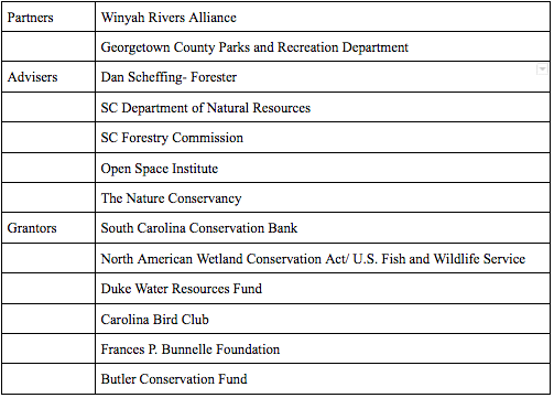
These partners joined by a team of advisers from other local entities makeup the steering committee which guides this project. Together our mission is to serve the public by protecting and restoring this ecologically important piece of land while providing recreation and education opportunities on the Black River and its associated upland forests.
This public access park includes a single lane paved boat ramp with floating dock as well as a separate kayak launch and a grass parking area for boat trailers. There is a picnic area adjacent to the boat launch. There is a network of “primitive” logging roads for hiking. The property is composed of wetlands, both bottomland and upland hardwood and planted loblolly and longleaf pine (in various phases of growth and management) and use of the park as an outdoor classroom is encouraged.

To stay up to date on the Rocky Point Community Forest, visit Facebook here>>
Background and Objectives
Formed by a unique partnership between local government and NGOs, Rocky Point Community Forest is the first park of its kind in the area. As a public use community forest it serves to achieve three objectives:
- Conservation and Restoration
- Recreation
- Education
For nearly 70 years Rocky Point was owned by International Paper and was managed by Georgetown Parks and Recreation as a public use park and boat ramp. When the property was sold in 2006 this much loved site was closed to public access. In order to reopen the site to the public and to protect the land from development, the partners came together to develop and implement a plan for the restoration and long-term sustainable management of the site.
Winyah Rivers Alliance purchased their portion of the park (462 acres) at the end of 2015 with grants from a number of supporters. This site is made up of 134 acres of wetlands (114 mature tidal forested freshwater, 17 acres of scrub shrub, and 3 acres of freshwater emergent) and 328 acres of associated uplands. The park protects 1.8 miles of river and creekfront providing access and enjoyment to all. On a larger scale this park, now permanently preserved, helps to connect 12,000 acres of protected land throughout the Black River watershed.
The park is also home to a historic family (Coachman) cemetery. Local experts have begun to research, catalogue, and make recommendations for the protection of this cultural asset.
Since the land was acquired, a steering committee has been formed to guide the work at the park. Also a forestry management plan was adopted, a strategy for the management was implemented and the site was reopened to the public in 2018 after the restoration of the boat ramp, and efforts to expand the passive recreation opportunities and community involvement are underway. A grant by the National Park Service’s Rivers, Trails, and Conservation Assistance Program was awarded in 2019 to aid in this effort (Ref: South Strand News).
Following a forestry management plan, the pine is being transitioned to longleaf pine (our threatened native pine ecosystem) where appropriate while the rest is sustainably managed to maintain healthy habitat for our native wildlife as well as to generate a modest revenue to be invested exclusively back into projects at Rocky Point.

